

The US-based National Aeronautics and Space Administration (Nasa) on Thursday shared the first two images captured by satellite NISAR, showcasing a portion of the American landscape, including a river, corn fields, wetlands, and forests in great detail.
Credited to be the world’s most expensive earth observation satellite built at a cost of over a billion US dollars, the Nasa-Isro Synthetic Aperture Radar or NISAR is a joint partnership between the Indian Space Research Organisation (Isro) and the US space agency.
NISAR was launched on July 30 from Sriharikota. Mounted with two synthetic aperture radars (SARs) – one each from Isro (S-band radar) and Nasa (L-band radar) – this satellite would capture images of the earth once every 12 days. Together, the two SARs will be able to capture complementary sets of images for the same location at the same time, providing a detailed view of the Earth. Both the L-band and S-band radars can see through clouds, smoke, rain and fog, helping obtain an unfiltered view of the planet across all weathers.
This specialised satellite will capture changes on the land surface caused by landslides, observe green cover and forests, the flow rates of glaciers and ice sheets, and even earthquakes and volcanoes.
Nasa said the detail with which NISAR scans the Earth will be able to provide unique, actionable information to decision-makers in a diverse range of areas, including disaster response, infrastructure monitoring, and agricultural management.
The first image taken by the L-SAR on August 21 was close to the Maine coast along the north-central region of the US. The image depicted forests, ground mass, river, and objects as small as five metres in size, indicating its high resolution. On August 32, the same SAR captured a larger region along North Dakota, an area flanked by farmlands, wetlands, forests, and an irrigated area.
‘Unprecedented detail’
The images demonstrate how the L-band SAR can discern the type of land cover – low-lying vegetation, trees, and human structures – in each area. “This capability is vital both for monitoring the gain and loss of forest and wetland ecosystems, as well as for tracking the progress of crops through growing seasons around the world,” Nasa said.
Story continues below this ad
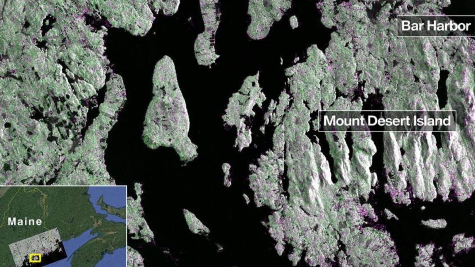 An image of Maine region captured on August 21 (Nasa)
“These initial images are just a preview of the hard-hitting science that NISAR will produce — data and insights that will enable scientists to study Earth’s changing land and ice surfaces in unprecedented detail while equipping decision-makers to respond to natural disasters and other challenges,” said Nicky Fox, Associate Administrator of the Science Mission Directorate at the Nasa Headquarters in Washington.
The L-SAR was raised to its intended orbit a few days ago. NISAR’s actual, full-scale science operations are expected to commence sometime in November.