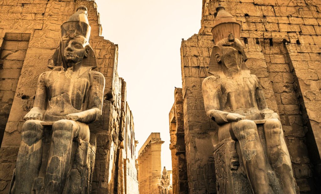
Just east of the Nile’s modern banks, in the heart of Luxor, Egypt, the vast Karnak Temple rises like a city of stone—its colossal columns, battered obelisks, and ram-headed sphinxes echoing millennia of royal ambition. But beneath this monumental complex, archaeologists have unearthed something even more ancient: a landscape that may have determined where—and why—Karnak was built in the first place.
New research led by an international team of geo-archaeologists suggests that Karnak’s foundations were laid not just on fertile ground, but on a natural island formed by the shifting channels of the Nile more than 4,500 years ago. And this high ground, surrounded by flowing water, may not have been chosen at random. Instead, it appears to mirror a scene from ancient Egyptian creation mythology—the moment the world began.
For centuries, historians believed the earliest structures at Karnak were built during Egypt’s Middle Kingdom, around 2000 BCE. But the new evidence, drawn from deep sediment cores and thousands of pottery fragments, pushes that date back to the Old Kingdom, possibly as early as 2300 BCE.

It’s a modest revision in archaeological terms, but one with outsized implications. It reframes Karnak not just as a temple complex, but as a deliberate physical embodiment of myth, a place where geography and theology were fused into limestone and ritual.
“It’s the only known area of raised land surrounded by water in the region,” said Dr. Ben Pennington, a geoarchaeologist at the University of Southampton and lead author of the study. “To ancient eyes, this may have looked like the moment of creation made real.”
A City Born From a River’s Retreat
The research, published in Antiquity by Cambridge University Press, centers on the geomorphic evolution of Karnak’s landscape. Using 61 sediment cores extracted across and around the temple site, the team reconstructed how the Nile’s channels moved over time—cutting, depositing, and reshaping the terrain long before stones were stacked.
Before 2520 BCE, the area was part of the Nile’s active floodplain. Seasonal inundations would have made it inhospitable to permanent settlement. But then, something shifted. Twin channels—one to the west, one to the east—carved into the floodplain and left behind an elevated river terrace.


This rise in the earth became dry, stable ground: an island, surrounded on both sides by water. It was here that early Egyptians laid the first foundations of what would become the most significant religious complex in their civilization.
The geological sequence matches up almost precisely with the earliest human traces found at the site—ceramics dating from c. 2305 to 1980 BCE, during the late Old Kingdom and First Intermediate Period. Together, the data builds a convincing case: Karnak began as a settlement on a river island.
Mythology Meets Topography
The alignment with Egyptian cosmogony is more than poetic coincidence. In Pyramid Texts dating from the same era, the world’s origin is described as a primordial mound rising out of chaotic waters. Later texts—like those from the Middle Kingdom—refine the idea, with the god Atum or Ra-Amun appearing on a high point surrounded by the primeval flood, known as Nun.
That symbolism appears carved in Karnak’s later architecture. But this new research suggests it may have been embedded in the site’s very selection. “This was a landscape that mirrored their religious imagination,” Pennington noted. “And that’s a powerful motivation to build.”


The discovery also reframes the city of Thebes (modern-day Luxor) as a religious capital that took shape not merely from royal decree or economic necessity, but from a nuanced understanding of the environment and a desire to reflect cosmological truths on Earth. The temple, in this view, wasn’t just a shrine—it was a manifestation.
Karnak today is recognized as a UNESCO World Heritage Site, drawing millions of visitors each year. But few realize the foundations of the site may have been chosen not just for politics or convenience, but for spiritual resonance rooted in the landscape itself.
Rethinking the Eastern Nile
One of the most unexpected findings involves the eastern Nile channel, long overshadowed by the better-documented western flow. Until recently, scholars viewed the east as marginal, even speculative. But the new core samples revealed a wide, active river branch east of Karnak, once potentially larger than the western channel.
This eastern flow, the study suggests, silted up gradually over time, as did its western twin. Ancient Egyptians took advantage of these shifts, building atop former channels as they stabilized. In some cases, they even manipulated the rivers, intentionally dumping desert sands into old waterbeds to create new construction zones.
According to Dr. Dominic Barker, a co-author of the study, “What we see is a dynamic interaction between people and their environment. They weren’t just reacting to the landscape—they were shaping it.”

